Project Survey with GPR, DGPS/GPS
Project Survey with GPR, DGPS/GPS
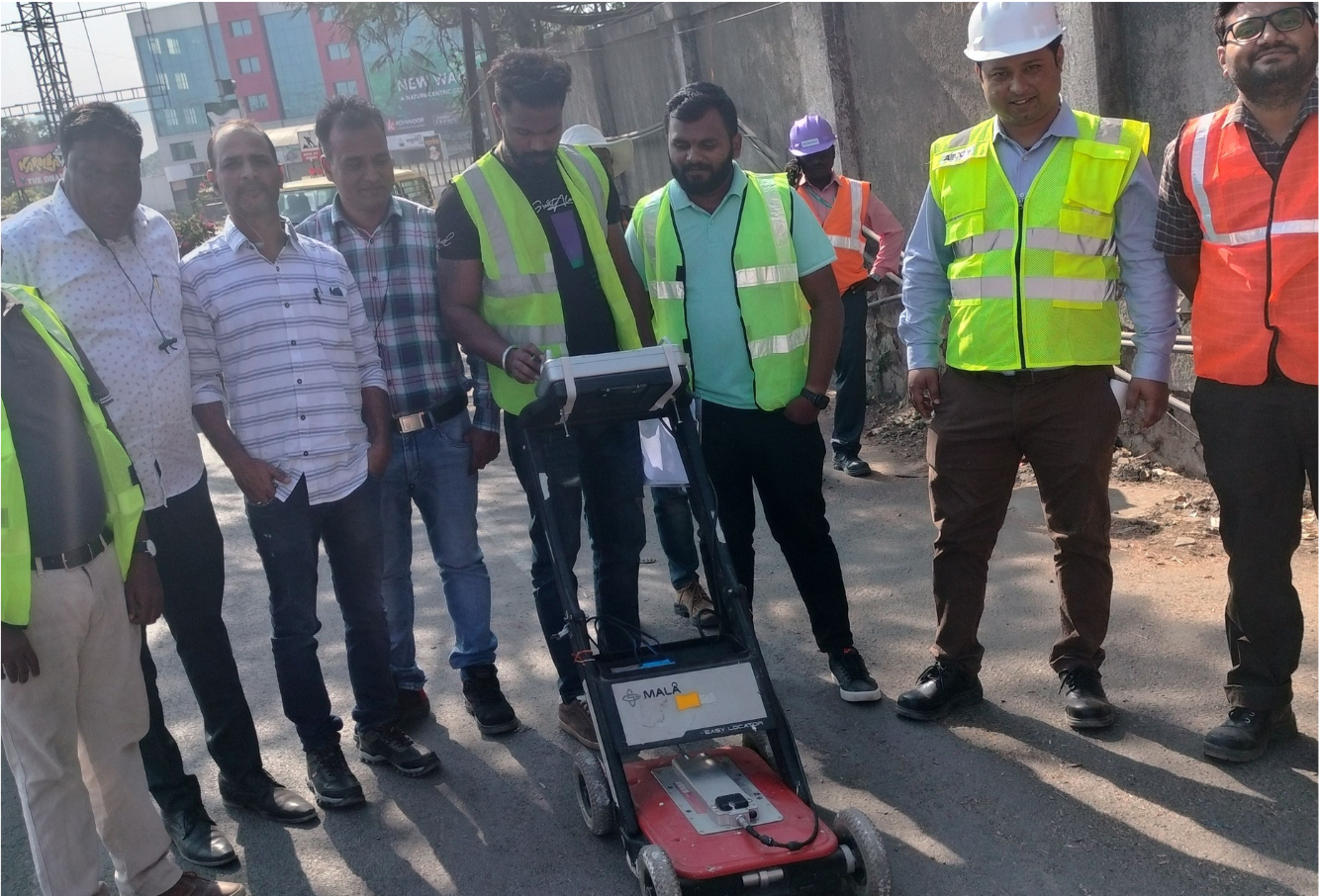
Electa Engineers leverages advanced Ground Penetrating Radar (GPR) and Electrical & Pipe Locator (EPL) technologies to perform detailed and accurate surveys for metro projects. These surveys provide essential mapping and analysis, crucial for informed project planning and execution. By utilizing these cutting-edge tools, we ensure that all subsurface elements are accurately identified and documented, reducing the risk of unexpected issues during construction.
What you can Expect
We create better opportunities to reach customers


Precision Data for Superior Planning
DGPS/GPS technology enhances survey accuracy by providing precise location data, reducing errors, and improving the reliability of the collected information.
Large-scale infrastructure projects, such as metro developments, benefit significantly from the high-precision data provided by DGPS/GPS surveys.
We provide comprehensive survey reports, including detailed documentation, analysis, and recommendations based on the data collected.
We create better opportunities to reach customers
Accurate Mapping for Informed Decisions
Ground Penetrating Radar (GPR) is a technology that uses radar pulses to image the subsurface, helping identify and map underground utilities and structures accurately.
Electrical & Pipe Locator (EPL) technology helps in accurately locating underground pipes and electrical cables, ensuring safe and efficient project planning.
We provide detailed survey reports and documentation, including comprehensive analysis and recommendations based on the collected data.
Your Questions, Our Expertise
Cost
of Work
We use advanced technologies such as Ground Penetrating Radar (GPR), Electrical & Pipe Locator (EPL), Differential Global Positioning System (DGPS), and Global Positioning System (GPS).
Our surveys provide accurate mapping and comprehensive data collection, essential for informed project planning and minimizing risks.
We provide detailed survey reports and documentation, including comprehensive analysis and recommendations based on the collected data.